French Quarter
Management District

Strengthening the District as a vital component of Louisiana’s tourism industry

  • About Us
    • Purpose & History
    • Board of Commissioners
    • Reports & Studies
    • Funding & Donations
    • Policies
    • Contact Us
  • Resident & Business Resources
    • Public Safety
      • Economic Development District
      • Supplemental Police Patrol Program
      • Upper Quarter Patrol
      • Dusk to Dawn – Keep it On!
      • SafeCam
    • Sanitation Services
    • Keep the Quarter Clean
    • Graffiti Resources
    • New Orleans Laws
    • Oversized Vehicles
  • Visiting
    • Maps
    • Festivals & Special Events
    • History of French Quarter
  • Meetings
    • Calendar
    • Committees
    • Documents
    • Public Comment Policy
    • Public Records Policy
  • News & Media

Maps

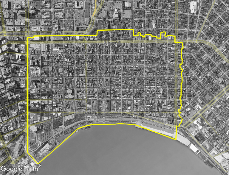
Please note the boundaries of the FQMD in RED. Click here or on the map to enlarge and download.

FQMD-Map-Large

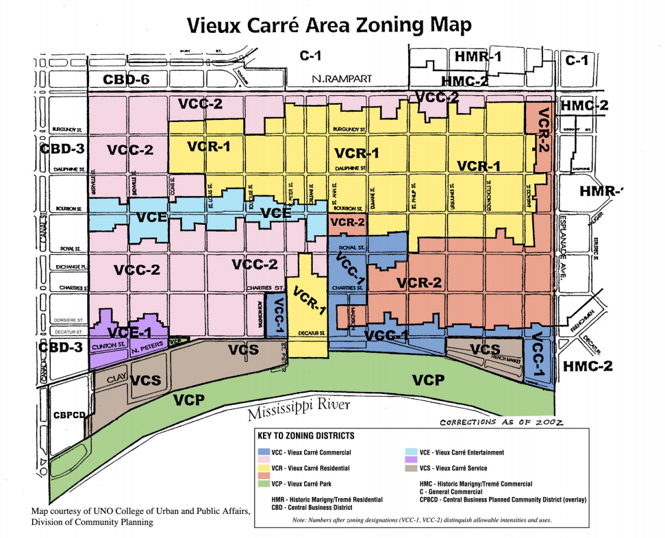
The Vieux Carré Area Zoning Map, courtesy of UNO College of Urban and Public Affairs, Division of Community Planning, was corrected in 2002. A colorized zoning key was implemented to make the designations distinguishable. Click here or on the map below for a larger version to review.

Vieux Carre Area Zoning Map

Subscribe Donate Now

  • This field is for validation purposes and should be left unchanged.

Donate Now

Copyright 2023 · French Quarter Management District · All Rights Reserved
400 North Peters Street, Suite 206, New Orleans, LA 70130 · 504-323-5801
· Photo Credits · Website by Tomatillo Design